What is a Local Nature Recovery Strategy?
Local Nature Recovery Strategies (LNRSs) are a new England-wide system of spatial strategies established by the Environment Act 2021.
The main purposes of these strategies are to:
- Help reverse the ongoing decline of nature in England by establishing priorities for nature recovery.
- Identify locations where effort can be focused to create or improve habitat most likely to provide the greatest benefit for nature and the wider environment.
- Inform the delivery of mandatory Biodiversity Net Gain (BNG) and guide local planning policy for nature recovery.
The goal is to drive nature’s recovery and in doing so provide wider gains, such as public access to nature, natural flood-risk management, and resilience to climate change.
The LNRS is not a delivery plan but a tool to identify the best opportunities for nature recovery. It will assist land managers, developers, planners, environmental organisations, community groups and residents to pursue opportunities to help nature recover, and to target action and funding.
Every LNRS is required to produce a statement of biodiversity priorities and a local habitat map.
The Statement of Biodiversity Priorities
- describes the area’s important landscapes, habitats and species
- describes the pressures on nature and opportunities for nature recovery
- includes a shortlist of priorities for nature recovery and potential measures (practical actions) to achieve the priorities relevant to the area
The Local Habitat Map includes two maps that are required as part of the draft LNRS:
- a baseline map to show current areas that are of particular biodiversity importance – ‘Areas of Particular Importance for Biodiversity’ (APIB)
- a targeted map to show future nature recovery opportunities – ‘Areas that Could become of particular importance for Biodiversity’ (ACBI).
– This shows where the measures (practical actions) for achieving the area’s shortlisted nature recovery priorities would be best located to make the most difference to nature.
Why we need a Local Nature Recovery Strategy
Great Britain is one of the most nature depleted countries in the world with nearly 1 in 6 species threatened with extinction. The UK’s comprehensive Report on the UK’s current biodiversity shows that wildlife is continuing to decline, largely due to the continuing intensification of human land use which, alongside climate change is resulting in a loss of the biodiversity we rely on and action is urgently needed.
By mapping where important habitats can be conserved, restored and connected, Somerset’s LNRS will allow effort and funding to be funnelled into the most important areas, supporting Nature Recovery across the landscape. The LNRS can also help to achieve the multiple environmental benefits that nature brings to people, such as clean air and water, reduced flood risk and socio-economic benefits such tourism or green prescribing.
When completed, our local LNRS will be knitted together with the LNRS created by the 48 Responsible Authorities across England to form a National Nature Recovery Network.

Our Statement of Biodiversity Priorities and Local Habitat Map
1. A Statement of Biodiversity Priorities
This describes the area’s important landscapes and habitats as well as the pressures on nature and opportunities for nature recovery.
Looking to the future, it also includes a shortlist of priorities for nature recovery and potential measures (practical actions) to achieve the priorities relevant to the area. This shortlist of priorities and potential measures is based on stakeholder engagement, expert input, a review of existing relevant environmental and spatial plans and strategies and takes into account the pressures on nature and opportunities for its recovery.
View the Statement of Biodiversity Priorities
2. Local Nature Recovery Strategy Local Habitat Map
The required LNRS Local Habitat Map contains two underlying maps:
i) Areas of Particular Importance for Biodiversity (APIB Map)
The baseline map of the LNRS area shows existing “Areas of Particular Importance for Biodiversity” – including national conservation sites, local nature reserves, local wildlife site and irreplaceable habitats. This is known as the “APIB” map.
ii) Areas that Could Become of Particular Importance for Biodiversity (ACBI Map)
The second map is a targeted map showing future nature recovery opportunities, known as the “Areas that Could Become of Particular Importance for Biodiversity” – or the “ACBI” map.
This shows, based on best-available mapping, modelling, and data, where the measures (practical actions) for achieving the area’s shortlisted nature recovery priorities would be best located to make the most difference to nature. Although nature recovery actions are encouraged everywhere, the map shows where the LNRS measures have the greatest potential to achieve nature recovery goals.
The ACBI map plots a number of the shortlisted measures from our final priorities and measures shortlist. These are the measures that relate to habitats, species and wider environmental benefits, and for which a defined, or targeted, area can be identified, where significant uplift in biodiversity is possible. Non-mapped shortlisted measures are just as important for nature recovery as mapped measures, however, due to factors such as data availability or the extent of land coverage, these measures were not selected for the ABCI map.
The locations identified in the mapped measures are based on underlying best-available data, and take into account existing habitat locations and type, topography, land use, soils, and the location of various constraints such as scheduled ancient monuments. Certain measures also consider the provision of wider environmental benefits.
It is important to note that the inclusion of a location in the Local Habitat Map does not require the landowner or other people and organisations to deliver the Potential Measures listed or prevent other legitimate land uses from taking place. The areas identified are ‘opportunities’ for nature recovery.
The Local Habitat Map is available to view on a separate portal.
Please take a look at the user guide before you go to the map.
What the Strategy will be used for
The Strategy will be used to:
- Guide investment into local priorities for protection and enhancement.
- Help shape how future funding for farming and land management such as the Environment Land Management schemes will be used.
- Map areas of opportunity for the use of ‘nature-based solutions’ to wider environmental problems like flooding, climate change mitigation and adaptation or poor water quality.
- Guide mandatory Biodiversity Net Gain (BNG) investments.
- Provide a source of evidence for local planning authorities, helping to understand locations important for conserving and restoring biodiversity.
Landowners are under no legal obligation to enact any of the recommendations on their land. But it will help direct funding streams, to help realise opportunities for nature recovery.

Who the strategy is for and how to use it
LNRS have been designed to be a tool with many uses but fundamentally they are about informing what type of action to take where for greatest environmental benefit. They represent an opportunity to target, align and integrate action for nature’s recovery that delivers the greatest overall benefit.
LNRS are designed to work with other legal requirements of the Environment Act 2021, namely:
- Targeting Biodiversity Net Gain – LNRS will determine where habitat creation or enhancement for BNG will be of ‘high strategic significance’ and benefit from a 15% uplift in the statutory biodiversity net gain metric (see above)
- Duty of public authorities to conserve and enhance the environment. LNRS will inform how all public authorities (water companies, government departments) in England meet their legal duties to conserve and enhance biodiversity. This could be through:
- managing areas of land they are responsible for in a way that supports what the LNRS proposes
- using the LNRS to inform relevant regulatory decisions that enable others to do so
- Planning – Guidance is awaited from the government to explain how Local Planning Authorities must comply with their duty to have ‘particular regard’ to LNRS.
As well as the legal role detailed above, the LNRS maps are designed to be used as follows.
Farmers/land managers
- The LNRS map will provide information to farmers and land managers to help them choose which Countryside Stewardship and Sustainable Farming Incentive options would be appropriate for their land.
- The LNRS map will help groups of farmers and land managers shape nature recovery priorities for their area, and to encourage collaboration across holdings and landscapes.
- The LNRS maps help identify opportunities for Landscape Recovery project proposals, and to provide evidence to support their application and project development.
- LNRS will inform how Defra’s arms-length bodies carry out existing functions to better support nature recovery. For example, drawing on LNRS priorities and proposals when providing land management advice to farmers, or when selecting locations for nature-based solutions such as natural flood management and tree planting.
Your questions and answers
Please visit the Information and common questions for farmers, landowners and land managers page for more information.
Councils
- LNRSs will be used to determine where habitat creation or enhancement for Biodiversity Net Gain (BNG) will be of ‘high strategic significance’. This means that creation or enhancement of habitat to generate biodiversity units for the purposes of biodiversity net gain gets a 15% uplift in the biodiversity metric, if that creation or enhancement follows what is set out in the LNRS
- LNRSs will inform the preparation of Local Plans enabling them to more effectively identify, map and safeguard areas for nature recovery, as required by national planning policy.
- LNRSs will be one source of evidence used to inform the preparation of development plans which will determine where development should occur, and these plan preparation processes have their own consultation and engagement requirements so that different needs for land can be balanced by the plan maker.
Environmental Non-Governmental Organisations
- LNRSs can leverage and target funding for environmental projects by LNRS Responsible Authorities and delivery partnerships (e.g. Local Nature Partnerships)
Business/private sector
- LNRSs can be used to inform where private companies choose to provide corporate donations for habitat creation or enhancement projects that deliver LNRS proposals.
Protected Landscapes
- LNRSs will inform the development and implementation of Protected Landscape management plan for the Chilterns, by identifying locations and measures that will drive delivery of the agreed targets and outcomes set out in this plan.
Wider use
- LNRSs will be used as criterion by Government when considering applications for funding for specific nature recovery activities.
- To leverage and target funding for environmental projects where they could have the most impact for nature and wider environment.
What the Strategy does not do
The final map produced for the LNRS, the Areas that Could Become of Particular Importance for Biodiversity (ACBI) map, shows the locations where LNRS measures (or practical actions) have the greatest opportunity to achieve nature recovery goals.
The map does not:
- Offer any new legal protections to land for the purposes of nature recovery or otherwise, that create restrictions on how land can be used or managed. LNRS do not propose new nature reserves or any other kind of legal designation.
- Stop development, or place new restrictions on developing land – LNRS will be one source of evidence used to inform Local Plans that determine where development should occur.
- Require action to be taken by landowners or managers as it is mapped – this will always remain their choice. The LNRS is a set of options where actions make best sense for nature – based on considerations such as existing local ecology, habitats, species dispersal distances, geology, soil type and topography.
- Prevent nature recovery work in areas not prioritised by the LNRS. The LNRS does not mean that areas within mapped locations are the only places where nature recovery actions should take place. We encourage action everywhere.
- Determine regulatory decisions, such as the result of Environmental Impact Assessments.
In total, our mapping covers the following percentage of the Somerset land area:
- Areas of Particular Importance for Biodiversity map – xx%
- Areas that Could Become of Particular Importance for Biodiversity – xx%
Engagement process so far
As the designated responsible authority, Somerset Council has led on the production of this Local Nature Recovery Strategy. However, an inclusive and collaborative approach has been taken to produce it.
Stakeholder engagement is key to the development of the LNRS. Our stakeholders include, but are not limited to, the following:
- environmental organisations and experts
- farmers and landowners
- residents
- town and parish councils
- businesses
- health and wellbeing
- community groups
A full list of those that have helped develop the LNRS is contained within the supporting draft evidence and technical information document – Appendix 1 – Governance and stakeholder engagement.
The strategy has been developed following the statutory and non-statutory guidance provided by DEFRA (The Department for Environment, Food and Rural Affairs) and Natural England, taking an evidence-based and locally-led approach.
Since September 2023, we have been gathering information to understand the pressures, opportunities and priorities for nature’s recovery in Somerset. During 2024/2025, we identified a draft set of priorities for nature through workshops with our stakeholders. We also gathered information on the pressures on nature that are the most urgent to address, and the benefits that nature provides that are vital for us. Stakeholders also told us how they would like the LNRS to be presented so it is user-friendly.
Stakeholder engagement has included:
- Stakeholders, and specialists on Somerset’s habitats and species: For example, Somerset Wildlife Trust, Natural England, the National Landscape Teams, Exmoor National Park Authority, the Woodland Trust, Somerset Peat Partnership, the RSPB, the Butterfly Conservation Trust and various other species specialists and groups, as well as the Somerset Environmental Record Centre (SERC)
- Engagement with Farmers, Landowners and Foresters: A Land Managers task group was set up with representatives from The Country Land and Business Association (CLA), the National Farmers Union (NFU), FWAG SW, and the Forestry Commission, who fed into the habitat work and helped with wider engagement through webinars and face-to-face workshops.
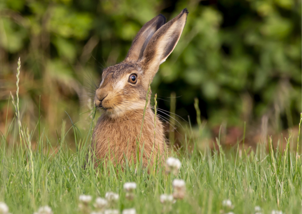
- Public Engagement Survey: We received 811 responses, highlighting the importance of hares, red deer, trees, and woodlands, and the importance of maintaining natural habitats for both ecological balance and human well-being. Concerns were raised about the impact of further development on green spaces.
- Engagement with sectors and Community/Place-Based groups: We engaged sectors such as Health, Businesses, parish and town councils, and Community/Place-Based groups.
Keep up-to-date

You can get regular progress updates in our monthly climate newsletter and on Somerset Council’s social media platforms. Sign up to Somerset Environmental and Ecological News.
