
Introduction
The Local Nature Recovery Strategy is a county‑wide plan that sets out how nature can be protected and restored across Somerset. It identifies priorities for nature recovery, maps the places where action could make the biggest difference, and helps guide decisions about land use, development and investment. This page answers common questions about the strategy, why it matters, and what it could mean for people, communities and nature in Somerset.
Purpose and overview
What is a Local Nature Recovery Strategy?
The LNRS is a tool to identify opportunities for nature recovery, which can be used to target action and funding. It is important to note that the LNRS is not a delivery plan and does not place any obligations or restrictions on landowners. It identifies the best opportunities and locations for nature recovery. However, this does not preclude nature recovery action in other locations.
Every LNRS includes two core elements:
- a Local Habitat Map, showing existing important habitats and areas suitable for nature recovery, and
- a Statement of Biodiversity Priorities, setting out local priorities for wildlife and the wider environmental benefits that nature recovery can deliver.
LNRS will be reviewed every 3 to 10 years from when the LNRS Regulations came into force in April 2023.
Why is the Local Nature Recovery Strategy needed?
We are in a global biodiversity crisis, and biodiversity is declining faster than ever before. The good news is that in many cases we know what we need to do to halt and reverse the declines of nature.
The purpose of the LNRS is to identify actions and locations where focussed, evidence-based and properly resourced activity should be prioritised at a local level, to continue to drive the recovery of nature. Using local knowledge to extend, improve, and join up existing important habitats, the LNRS acknowledges what is already here in Somerset, as well as identifying the creation of new areas that may become important for biodiversity in the future.
The LNRS is designed to integrate with existing plans and strategies to create a joined-up approach to nature recovery.
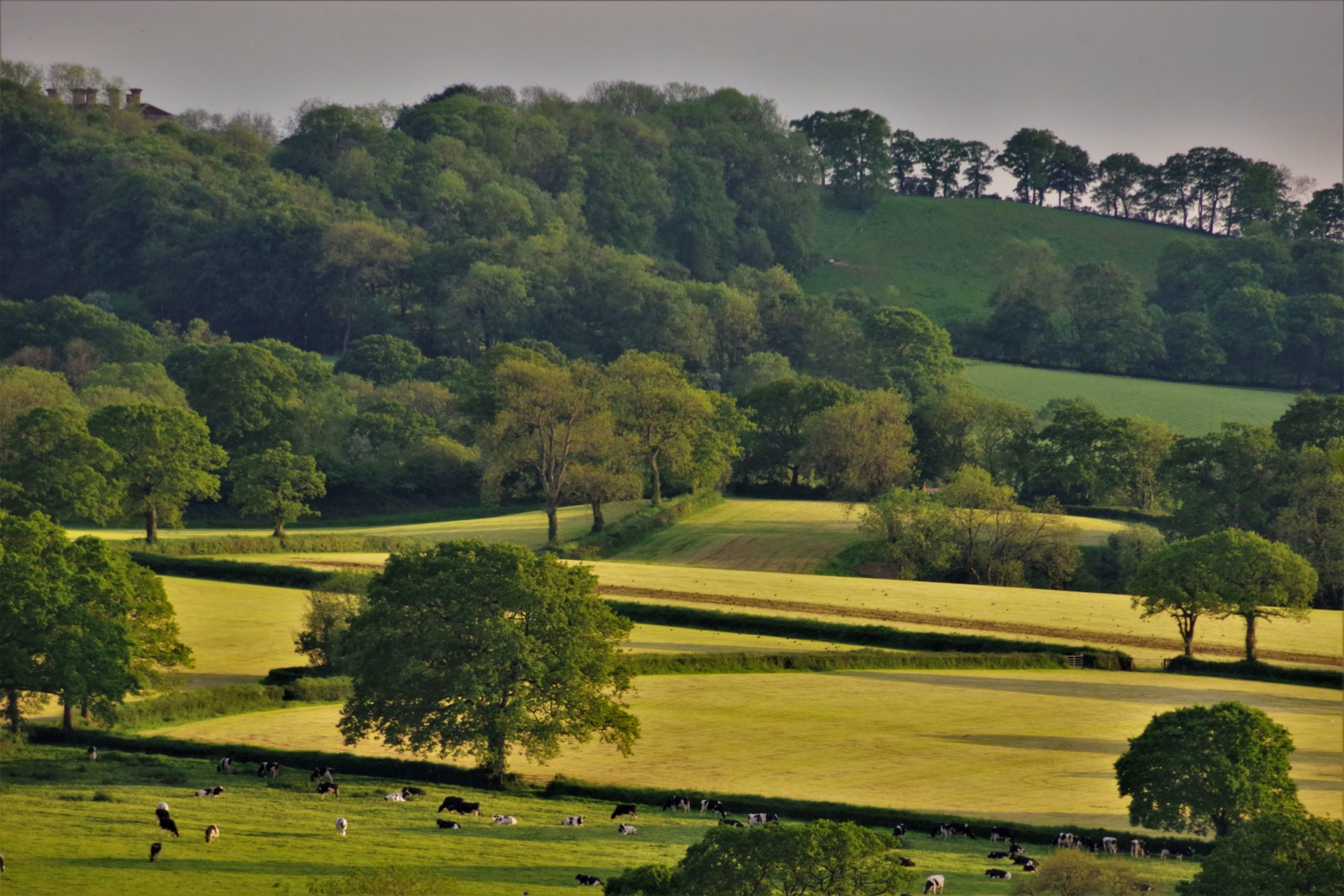
We are in a global biodiversity crisis, and biodiversity is declining faster than ever before. UK wildlife has, on average, declined by 19% since 1970. Many of the country’s most important habitats are now in poor condition.
Evidence from the Somerset State of Nature Report 2023 shows this crisis is reflected locally. In Somerset, terrestrial insects such as butterflies have declined significantly, nonnative species have expanded rapidly, and large areas of species rich grassland have been lost. Habitat quality, extent and species richness have all decreased, demonstrating that existing efforts have not been sufficient to halt biodiversity loss.
LNRS provides a critical framework to help reverse these trends by targeting action where it is most needed and effective.
The decline of nature has wide ranging consequences beyond wildlife. Nature recovery is also essential to our daily lives in ways that we cannot easily see, including:
- supporting food production and local economies
- pollinating our crops
- connecting and expanding areas for nature so that wildlife can thrive and move across the county
- reducing the impacts of extreme weather events
- improving air, soil, and water quality
- providing recreational and educational opportunities
- boosting our mental and physical wellbeing
- helping us to mitigate and adapt to climate change.
See Chapter 1.3 Nature is in Crisis and Chapter 1.4 The State of Nature in Somerset
What does the Local Nature Recovery Strategy aim to achieve?
The purpose of the LNRS is to identify actions and locations where focussed, evidence-based and properly resourced activity should be prioritised at a local level, to continue to drive the recovery of nature. Using local knowledge to extend, improve, and join up existing important habitats, the LNRS acknowledges what is already here in Somerset, as well as identifying the creation of new areas that may become important for biodiversity in the future.
By providing a single, agreed framework, it helps align the actions of local authorities, land managers, communities, developers and funders. It guides planning, investment and land use decisions, supports delivery of national environmental targets under the Environment Act 2021, and helps ensure that funding for nature also delivers wider benefits such as climate resilience, flood management and improved wellbeing.
Whilst the Strategy makes no requirement for its measures to be implemented, it offers a comprehensive guide to nature recovery that will present many strategic and financial benefits to farmers, landowners, planners, developers, community groups and others, in taking forward the measures.
How does the Local Nature Recovery Strategy differ from biodiversity strategies that have come before this one?
Local Nature Recovery Strategies (LNRS) differ from previous biodiversity strategies by being statutory, spatially targeted, and integrated with funding and policy.
Key differences:
- Statutory status: Unlike previous, non-statutory plans, LNRSs are legally required under the Environment Act 2021. This gives them greater authority and a direct link to government action.
- Spatial mapping: LNRSs move beyond general goals by including a local habitat map. This map pinpoints Areas of Particular Importance for Biodiversity (APIBs) and identifies specific Areas that Could Become Important (ACBIs), making them a tangible planning tool.
- Integrated with policy: The strategies are a crucial part of new environmental policies. They are the spatial targeting mechanism for Biodiversity Net Gain (BNG) and guide where public funding, like the Environmental Land Management Schemes (ELMS), can be most effectively used.
- Focus on recovery: While older strategies focused on conservation, LNRSs are explicitly about active recovery. They aim to create a bigger, better, and more connected Nature Recovery Network across the country, building on the principles of the Lawton Report.
Furthermore, it is more comprehensive than any previous Somerset nature strategy. Never before has so much up-to-date information and knowledge been brought together to guide nature’s recovery.
What the Somerset Local Nature Recovery Strategy includes
What is in the Somerset Local Nature Recovery Strategy?
The Strategy is made up of two main elements, a Statement of Biodiversity Priorities, and a Local Habitat Map.
The Statement of Biodiversity Priorities, includes:
- A description of Somerset and its biodiversity.
- A summary of pressures on Somerset’s biodiversity and opportunities for recovery.
- Priority Outcomes (the long-term end results that the strategy is seeking to achieve).
- Potential Measures (actions, which can be taken to contribute to achieving each agreed priority and deliver wider benefits).
The Local Habitat Map identifies:
- Areas of Particular Importance for Biodiversity. These include Somerset’s internationally, nationally, and locally designated sites, as well as statutory irreplaceable habitats.
- Locations where Potential Measures, including creation or restoration of habitats as well as bespoke action for target species, could deliver the greatest gains in terms of nature’s recovery, wider benefits for the environment and people, and the most investible opportunities for private investment in nature’s recovery. Together these form Areas that Could Become of Particular Importance for biodiversity. There may be a number of potential measures mapped in the same location. For any location, all mapped potential measures should be given consideration prior to selecting the most suitable option.
What opportunities (priorities and measures) for nature recovery were identified?
Lawton’s principles of more, bigger, better, and joined-up provide a framework to create a robust network of habitats that can better support biodiversity and withstand the impacts of climate change.
Sitting within the 8 Habitat themes are 52 priorities which outline the outcome we want to see for nature in Somerset. Priorities were developed with stakeholders through a series of workshops, focusing on outcomes that tackled the county’s most notable pressures and challenges and supported delivery of local and national ambition against our most significant, important and/or at risk habitats.
The Strategy also identifies priority species that action should be focused on – there are 150 priority species from across all taxa, selected not only on the basis of need and urgency but also in consideration of whether action for them would also support the recovery of other species associated with their habitat assemblage.
To achieve the 52 priorities there are a number of potential measures – these being the proposed action to deliver the priority, targeted to where it will deliver the greatest gains and benefits.
The following is a brief summary of priority outcomes and measures to create and restore new habitats (more), extend (bigger) and improve (better) existing habitats, and to connect (joined up) important landscapes for nature, as provided in Chapter 4.
Chapter 4: Opportunities for Nature Recovery
The priorities and measures described are consistent with UK Habitat Classification and Somerset’s Nature Vision.
Coastal – What the Local Nature Recovery Strategy aims to deliver
A coastal environment that is:
- Bigger, better and more connected, with restored saltmarsh, mudflat, dune and shingle systems.
- Climate adaptive, allowing habitats to move and evolve naturally as sea levels rise.
- Ecologically resilient, supporting coastal birds, fish, marine mammals and intertidal species.
- Joined up from catchment to coast, linking rivers, wetlands, coast and sea.
- Cleaner and better managed, with reduced pollution and disturbance.
Key Actions
- Restore and create saltmarsh and mudflats, including managed realignment.
- Create high tide roost habitat for coastal birds.
- Protect existing shingle, dunes and saltmarsh using nature-based approaches.
- Reduce wildlife disturbance through access management.
- Improve water quality using nature-based solutions.
- Protect marine and intertidal habitats, including kelp forests.
Moorland and Heathland – What the Local Nature Recovery Strategy aims to deliver
Moorland and heathland that is:
- Restored to favourable condition, with healthier peat, heath and mire systems.
- Bigger, better and more connected, forming resilient habitat networks and steppingstone corridors.
- Hydrologically functional, with rewetted peatlands and naturally functioning blanket bog and valley mire.
- More resilient to climate change, including drought, wildfire and extreme rainfall.
- Delivering wider public benefits, including cleaner water, carbon storage and reduced flood risk.
Key Actions
- Rewet blanket bog and valley mire (for example, ditch blocking, hag reprofiling, targeted grazing).
- Promote sphagnum recovery and restore peat forming processes by reducing dominance of Molinia, bracken and gorse.
- Reduce erosion and runoff from upland plateaux to protect sensitive mire systems.
- Manage recreation and fire risk, including coordinated visitor management and behaviour change.
- Restore habitat mosaics, including wet heath, scrub and standing water, to support wildlife and resilience.
See Chapter 4.3B Moorland and Heath
Grassland – What the Local Nature Recovery Strategy aims to deliver
Grasslands that are:
- Bigger, better and more connected, with restored and newly created species rich grassland networks.
- In favourable condition, with improved botanical diversity and appropriate long-term management.
- Supporting pollinators and invertebrates, reversing declines in key species groups.
- Better understood and monitored, enabling adaptive management and long-term recovery.
- Strengthening ecological networks, linking grasslands with wetlands, woodlands and farmland habitats.
Key Actions
- Protect and restore existing species rich grasslands, prioritising sites of highest ecological value.
- Create and enhance new grasslands where they deliver the greatest benefit for nature recovery and connectivity.
- Improve grassland management, including appropriate grazing and cutting regimes and reduced nutrient inputs.
- Reintroduce wildflowers and seed sources, using methods such as green hay and local seed where appropriate.
- Monitor grassland condition and species, particularly pollinators and invertebrates, to guide future management.
Woodland and hedgerow – What the Local Nature Recovery Strategy aims to deliver
Woodland and hedgerow networks that are:
- In favourable condition, with improved age structure, species diversity and long-term management.
- Bigger, better and more connected, buffering existing woods and linking sites through hedgerows, orchards and trees outside woodland.
- Functioning as resilient ecological networks, supporting priority species and movement across the landscape.
- Delivering multiple benefits, including carbon storage, soil protection, water regulation and climate resilience.
- Safeguarding irreplaceable habitats, including ancient woodland, veteran trees and traditional orchards.
Key Actions
- Protect and improve existing woodlands, prioritising ancient and seminatural sites through appropriate management.
- Expand woodland cover and connectivity, using natural regeneration and targeted planting to link habitats.
- Restore and expand traditional orchards, strengthening cultural landscapes and supporting priority species.
- Enhance hedgerow networks, making them wider, taller and more structurally diverse, with more hedgerow trees.
- Increase trees outside woodland, including in farmland and settlements, to strengthen landscape scale connectivity.
See Chapter 4.3F Woodland and Hedgerow
Freshwater – What the Local Nature Recovery Strategy aims to deliver
Freshwater systems that are:
- Healthier and more natural, with improved water quality, flow and habitat structure.
- Better connected, with rivers relinked to floodplains and wetland networks.
- Bigger, better and more joined up, forming resilient ecological corridors across catchments.
- Supporting recovering wildlife populations, including fish, otter, water vole and aquatic invertebrates.
- More resilient to climate change, reducing flood risk, improving drought resilience and storing water in the landscape.
Key Actions
- Restore natural river processes, reconnecting rivers to floodplains and allowing space for channels to move.
- Improve water quality, reducing nutrient and pollution inputs from wastewater, development and agriculture.
- Enhance rhynes, ditches and ponds, through sensitive management, buffering and creation of new features.
- Remove or modify barriers to improve fish passage and ecological connectivity.
- Create riparian buffers and wetlands, using nature-based solutions to slow flows and improve habitat.
Lowland Wetland – What the Local Nature Recovery Strategy aims to deliver
Lowland wetlands that are:
- Bigger, better and more connected, with restored and expanded wetland networks across catchments.
- Hydrologically functional, with sufficient water quality and quantity to sustain wetlands and peat forming systems.
- Supporting recovering wildlife, including wetland birds, aquatic plants and invertebrates.
- Delivering climate resilience, storing more carbon, reducing flood risk and improving drought resilience.
- Improving water quality, acting as natural filters within the wider landscape.
Key Actions
- Restore and manage wetlands, using appropriate grazing, low input cutting, high water level management and reduced reliance on pumping.
- Rewet and restore peatlands, ending damaging practices and supporting peat forming processes.
- Deliver nature-based flood management, slowing flows and increasing water storage across wetland landscapes.
- Reduce nutrient and phosphate pollution, tackling sources upstream from sewage, development and agriculture.
- Create protective buffer zones around sensitive fen and bog habitats to prevent diffuse pollution.
See Chapter 4.3G Lowland Wetland
Urban – What the Local Nature Recovery Strategy aims to deliver
Urban environments that are:
- Greener and more nature rich, with high quality green and blue spaces embedded across towns and villages.
- Better connected, enabling wildlife to move through urban areas via green corridors, trees, hedgerows and watercourses.
- Healthier and cleaner, with improved air, soil and water quality through nature-based solutions.
- More resilient to climate change, reducing heat stress, surface water flooding and pollution.
- Delivering social value, improving health, wellbeing and everyday access to nature for residents.
Key Actions
- Protect and expand urban green and blue spaces, including parks, river corridors and local nature sites.
- Improve connectivity, linking habitats through street trees, hedgerows, permeable boundaries and green infrastructure.
- Create biodiverse urban spaces, using native planting, ponds, wildflower areas, green roofs and walls.
- Reduce pollution, including pesticides, herbicides and nutrient inputs in public and private spaces.
- Manage light, noise and recreational pressures, creating darker, quieter refuges for sensitive species.
Farmland – What the Local Nature Recovery Strategy aims to deliver
Farmland landscapes that are:
- Richer in wildlife, with increased diversity and extent of habitats such as hedgerows, grass margins, ponds and trees.
- Better connected, enabling species to move between grasslands, wetlands, woodlands and rivers.
- Healthier and more resilient, with improved soil structure, water retention and reduced pollution.
- Climate resilient, better able to cope with flooding, drought and changing weather patterns.
- Productive and sustainable, supporting profitable farming alongside nature recovery.
Key Actions
- Enhance habitat complexity on farmland, including wider field margins, hedgerows, scrub, ponds and infield trees.
- Improve soil health, through reduced compaction, appropriate grazing, cover crops and lower chemical inputs.
- Reduce pollution and run off, protecting watercourses, wetlands and downstream habitats.
- Integrate trees and hedges into farming systems, including agroforestry and shelterbelts.
- Support collaboration, through farm clusters, catchment-based approaches and shared learning.
What is the difference between Priorities and Measures?
Priority outcomes describe the intended results for nature. They set out the strategic ambitions for recovering or enhancing habitats, species, or ecological functions across the LNRS area. Priorities are set collaboratively and reflect both local needs and national environmental targets.
Priority outcomes answer the question: “What does success for nature look like here?”
Measures describe the practical actions that could help deliver the priority outcomes.
They answer the question: “What kinds of actions could help us get there?”
Measures are practical, but not prescriptive – they inform and guide voluntary action rather than imposing it. They are often mapped to show where they will have the most significant impact.
Why don’t the measures have quantifying targets?
The strategy is directed by Defra and Natural England and devised following statutory guidance. Responsible authorities have been told not to include targets in the local nature recovery strategy.
We recognise that this is an important missing element in terms of allowing the strategy to monitor its progress – and will be particularly important at review and revision. Once the strategy is published, Somerset’s delivery partners for nature recovery will need to consider if and how we feel this gap.
Who is the strategy for and how will it be used
How will the Somerset Local Nature Recovery be used, and who is it for?
How can you use the Local Nature Recovery Strategy?
We have designed the LNRS to:
- guide public authorities in meeting their legal duty to protect and enhance biodiversity.
- highlight priority areas for nature recovery and encourage local involvement.
- identify sites for habitat creation and improvement.
- support local planning and align it with wider nature recovery goals.
- help secure funding for nature projects.
- encourage community nature groups.
- boost the benefits of nature for community health and wellbeing.
- map key locations where habitat work will have the greatest impact.
See Chapter 2 How to use the LNRS
Who is it for?
The Somerset Local Nature Recovery Strategy (LNRS) is designed for everyone with a role in caring for, using or shaping land and nature in Somerset. Its purpose is to support collaborative action to improve the state of nature across the county.
- Farmers, foresters, landowners and land managers can use the LNRS to understand which priority areas their land falls within, identify suitable habitat actions, access grants and incentives aligned with LNRS priorities, and work collaboratively across landscapes.
- Developers and planners can use the LNRS as an evidence base to guide development decisions, deliver Biodiversity Net Gain (BNG) in the right places, support planning decisions, and inform the designation of new local wildlife sites.
- Public bodies and environmental organisations can use the LNRS to help meet legal duties to conserve and enhance biodiversity, support funding bids, raise awareness, undertake ecological assessments, and build partnerships for delivery.
- Individuals, community groups and businesses can use LNRS maps to identify local opportunities for nature recovery, develop practical action plans, and set up or join community led nature projects.
- Town and parish councils can use the LNRS to develop Local Nature Action Plans, shape biodiversity friendly planning and land management, apply for funding, engage communities, and support climate resilience and flood prevention.
Overall, the LNRS provides a shared framework that helps different groups work together to deliver lasting benefits for nature, people and places across Somerset.
See Chapter 5 Working together
How will a LNRS benefit Somerset?
- Developers and Planning Authorities: The LNRS will be used as a long-term decision-making tool to help guide mandatory Biodiversity Net Gain and other planning tools such as Green Infrastructure.
- Farmers and Land Managers: The LNRS will be used to inform applications for funding from ’future of farming in England’ scheme, supporting Somerset’s agricultural sector. It will also help steer opportunities for nature-based solutions such as flood risk management and sequestering carbon through new trees, woodlands and healthier soils.
- Somerset Residents and Communities: By involving local communities in the development and implementation of the LNRS, it will foster a sense of local ownership, responsibility, and appreciation for biodiversity.
- Businesses and the Local Economy: The LNRS will play an important role in bringing green investment into the county from national and international funding sources and creating local opportunities for Somerset businesses to achieve their environment and social governance (ESG) objectives.
LNRSs are not designed to be prescriptive. They are tools to drive forward action to recover nature.
The LNRS does not dictate how land is used or be used, nor is it intended to be used as a way of limiting the choices land managers have on their land. The maps will provide a range of options and help people and organisations make evidence-based decisions.
The LNRS will not be used to:
- require land managers or owners to make specific proposed land use changes. This will remain their choice
- place new restrictions on developing land or act as a specific blocker for proposals
- assign new legal protections that create restrictions on how land is used or managed
- propose new nature reserves or any other kind of legal designation
- prevent nature conservation in areas that are not prioritised by the LNRS
- determine regulatory decisions, such as the result of Environmental Impact Assessments.
While the Strategy will set out priorities for nature recovery, it is not an action plan and therefore these will be recommendations and not commitments for delivery. The delivery of the Strategy will involve a range of organisations, community and special interest groups, residents, landowners and communities, and therefore cannot be delivered by the Council alone. It is hoped, however, that the LNRS will enable partners to take advantage of funding opportunities to work together to deliver the priorities identified.
Is this a Somerset Council strategy? Will the Council be responsible for its delivery?
The strategy is not a Somerset Council strategy – the authority was simply the authority responsible for preparing it in consultation with partners and stakeholders.
Our appointment was by Defra and the Secretary of State. Somerset Council was provided with a grant to develop the strategy.
The strategy is the county’s – the purpose of the wide participation of stakeholders and partners was to ensure endorsement and adoption. Delivery of the strategy’s priorities will be by a multitude of partners and will require collaborative working.
There is no “responsibility” for delivery – the strategy serves to direct action for nature in respect of what is most needed and where it is most needed – there is no onus to take action.
Delivery, monitoring and review/update of the strategy will need a coordinating body, which will be undertaken by Somerset Council. The delivery role is made up of four key functions:
- Lead and convene a delivery partnership to plan and prioritise delivery
- Embed LNRS into local decision making
- Identify priority strategic projects and facilitate project development
- Monitor and report on delivery of nature recovery activities in the LNRS area
Planning policy and wider links
What is the relationship between the Local Nature Recovery Strategy and Planning?
National Planning Practice Guidance paragraphs 46 to 48 explain the relationship between LNRS and planning.
The LNRS is intended to support local planning authorities in preparing local plans that conserve and enhance biodiversity and the natural environment, and local planning authorities have a legal duty to have regard to the relevant strategy for their area. Local planning authorities should consider the priorities set out in the LNRS when determining how their local plan should contribute to and enhance the local and natural environment.
The LNRS is an evidence base which contains information that may be a ‘material consideration’ in the planning system, especially where development plan documents for an area pre-date the publication of the LNRS. It is for the decision-maker to determine what is a relevant material consideration based on the individual circumstances of the case.
What is the relationship between the Local Nature Recovery Strategy and Biodiversity Net Gain (BNG)?
The LNRS identifies areas where habitat creation, restoration or enhancement would be most beneficial for nature recovery and wider environmental outcomes. It plays a critical role in supporting offsite gains to be delivered in a way that maximises biodiversity benefits, when these are required to achieve a development’s biodiversity gain objective. This can help to support bigger and more joined-up areas in which our wildlife can thrive.
The areas identified within the Potential Measures layer of the Local Habitat Map carry strategic significance in the BNG metric and therefore are worth more than BNG delivered outside of the mapped areas. This helps to focus where BNG is delivered to ensure the best outcomes for nature.
Farming, land use and food production
What are the implications for farmers and landowners?
The LNRS is not a delivery plan, and it does not force farmers, landowners, local authorities, or other agencies to deliver the works identified in the LNRS. It should also be noted that areas that are mapped in the LNRS for habitat creation or improvement do not prevent other legitimate land uses, do not place new restrictions on developing land, and do not identify areas to be given legal protection.
For further information please see the Local Nature Recovery Strategy – Questions from farmers, landowners and land managers
How does the Local Nature Recovery Strategy support agriculture and food production?
By supporting nature, we can grow food on our best farmland. At the same time, we can set aside less productive land for nature to recover. Recovering nature benefits food production and agricultural land by:
- helping to improve soil and water quality
- increasing the number of pollinators
- supporting adaptation to extreme weather; and
- creating more resilient farmland habitats.
Somerset’s LNRS can help landowners, managers, and tenant farmers identify locations for nature recovery on their land. This will support landowners and managers in applying for funding for environmental improvements. These schemes can boost farm income by ensuring farmers get paid for restoring nature while also growing food.
For further information, see Local Nature Recovery Strategy – Questions from farmers, landowners and land managers
Funding and delivery
How will nature recovery be funded once the Local Nature Recovery Strategy is published?
Funding to support the preparation and publication of Somerset’s LNRS was provided by The Department for Environment, Food and Rural Affairs (Defra).
Once adopted the LNRS will help lever in funding for nature recovery using the range of tools and incentives referred to in the Strategy.
The government offers different funding options to encourage landowners and managers to support nature recovery activities. These include, but are not limited to:
- Farming in Protected Landscapes
- Environmental Land Management Schemes
- Sustainable Farming Incentive
We have designed the LNRS to complement other environmental schemes and financing, such as Biodiversity Net Gain (BNG). The nature recovery actions in the LNRS can help find key areas for off-site BNG delivery. The mapping can be used to determine the ‘strategic significance’ score in the BNG metric. This means that if biodiversity gains are delivered in LNRS key areas, then within the biodiversity metric, they will be worth 15% more.
How the strategy was developed and updated
How has the LNRS been created?
The Somerset Local Nature Recovery Strategy (LNRS) has been developed through a careful, evidence led and collaborative process, bringing together national requirements, local knowledge and community voices to create a shared plan for nature’s recovery across the county.
If you’d like to know more about how the development of the mapping and strategy, along with changes made as a result of the public consultation, click on the links below:
See Appendix A – Developing the LNRS, Data, Evidence and Methodology
Development of the strategy
The core delivery team at Somerset Council were responsible for creating and drafting the LNRS. The strategy was developed in partnership with the Somerset Local Nature Partnership, which acted as a steering group and helped guide the overall direction of the work. Drafting the LNRS included input from a range of sources, including existing environmental strategies, documents and action plans, as well as direct feedback from local experts and stakeholders. Collaboration with stakeholders has played a central role in shaping the strategy throughout the process.
An evidence based approach
The LNRS is grounded in the best available evidence. Its development included:
- Analysis of local and national habitat and species data
- Review of protected sites and priority species
- Mapping where nature is already most valuable and where action would make the biggest difference
For a full list of the members of the advisory groups and the work they have undertaken, please consult
Appendix A – Developing the LNRS, Data, Evidence and Methodology
Listening to communities and stakeholders
From the beginning of the process, Somerset Council has engaged with a wide range of local stakeholders. These include conservation groups, the public, landowners, land managers, government bodies, town and parish councils, businesses and community organisations. Engagement activities included a public and landowner survey, a series of workshops with the partnership steering group and themed working groups, and attending various webinars and events. Feedback from surveys, workshops, events and written responses was used to refine priorities, actions and mapping, helping ensure the final strategy reflects what matters most to people in Somerset.
We received 811 responses to a Public Engagement Survey, where we asked for views to ensure the Somerset Local Nature Recovery Strategy reflects local priorities and real world experience, alongside scientific evidence. This helped shape what actions matter most and where nature recovery can make the biggest difference across Somerset.
The engagement process has been crucial to ensure that the strategy is geographically and ecologically relevant to Somerset and has local support.
Supporting authority consultations and public consultation
To gain formal approval and endorsement of the LNRS, responsible authorities were required to undertake three consultations before its publication. Two of these consultations were with our Supporting Authorities (Natural England, Forestry Commission, Environment Agency and Exmoor National Park Authority) and one was a Public Consultation. The purpose of these consultations were to gain feedback on the Statement of Biodiversity Priorities and Local Habitat Map, as well as the existing nature in Somerset, opportunities we’ve identified for nature’s recovery, case studies demonstrating success of nature recovery work and our methodologies for creating the LNRS. We incorporated feedback from the consultations into the final strategy, before its publication. Overall, a total of 265 responses to the public consultation were received: 135 online survey responses, 15 detailed stakeholder responses and 115 comments on the Local Habitat Map.
A living strategy for the future
The Somerset LNRS is designed to be a living strategy. It brings together national policy, local evidence and community input to guide action and investment over the long term. As new evidence emerges and progress is made, the strategy will be reviewed and updated, helping Somerset respond to changing environmental challenges and opportunities.
How often will the strategy be updated?
LNRSs must be reviewed, updated, and republished every 3 to 10 years, as instructed by the Secretary of State. This process ensures that the strategies remain relevant and can track the progress of nature recovery over time.
Maps, data and technical detail
What is the local habitat map and how was it created?
The Local Habitat Map is the map-based part of the Somerset Local Nature Recovery Strategy (LNRS). It shows where Somerset’s most important habitats are today and where there are the best opportunities to restore, create and connect habitats in the future. Using the best available evidence, the map highlights key wildlife sites, areas where nature recovery could deliver the greatest benefits, and how habitats can be linked together to form stronger, more resilient nature networks. The map does not allocate land for development or require landowners to take action; instead, it provides clear, strategic guidance to help communities, land managers, planners and funders focus effort and investment where it will make the biggest difference for nature and people.
To create Somerset’s local habitat map we combined geospatial analysis, stakeholder input and the statutory guidance from Defra. You can read about the technical methodology that went into creating the different data layers below:
See Appendix A – Developing the LNRS, Data, Evidence and Methodology
What is the difference between the APIB, ACBI in the Local Habitat Map?
The local habitat map for the LNRS includes the areas of particular importance for biodiversity (APIB) and areas that could become of importance for biodiversity (ACBI) – it identifies the areas of strategic significance for the LNRS.
The areas of particular importance for biodiversity (APIB) shows the areas of the county that are assumed to already have some level of protection and management, through planning and/or as a result of associated legislation. This is limited to nationally designated sites, local wildlife sites, local nature reserves and irreplaceable habitats.
The areas that could become of particular importance for biodiversity (ACBI) shows the areas of the county considered to be where the greatest gains for nature recovery, and wider environmental benefits, would be realised if action was targeted there. These areas place a priority on areas which improve connectivity of the strategy area and support the buffering and/or linking of areas of particular importance within the wider landscape.
What do the potential measures show?
These mapping layers identify areas where the potential measures could be delivered – based on greatest gains and benefit. They provide a useful guide for where to target different types of nature recovery action and can be used by any groups or organisations to steer this type of activity.
The potential measures are not an instruction, rather they are an informative and therefore they do not dictate what should, or shouldn’t, happen.
All potential measures that could be mapped, have been mapped, even if this was only to the extent of basing opportunity on existence of habitat type or potential for that habitat type. Appendix A shows which measures were mapped and which were unmapped.